
One of the reasons I fish and probably the biggest reason is simply to get out into some place quiet and try to fool nature into letting a fish take my line. For a time I looked only for the biggest fish I could land, but lately I've came unto the realization of just how much water is out there left unexplored. I love finding new spots and small streams that most people drive by everyday. The larger lakes are packed out and I believe that most think the better fishing opportunities exist only there, but I can attest to the quality of fishing those small blue lines on the map. I can also tell you that I know of places where there is no trash laying stream side, no noise from the roads, no loudmouths announcing every hook set they miss... Most of us try to get away from the business of life and that includes technology but theres a beautiful advantage of tech that I've been enjoying the past few years: Google Maps.
Plotting the Adventure
Have you ever had those friends that usually end the conversation with "we should hang out sometime..."? Those who say this at the terminal end of conversations rarely pick up the phone to give you a ring or are to busy every time you call... fishing new water tends to be the same for me. If I don't plot a point and make plans to visit there chances are I'll forget about it or never get around to putting the drive together. I like to dial up new spots using google maps and put a little star on where I'm going to build up my hit list of go-to's for the upcoming fishing season. I've covered and found a lot more fishing holes that way.
This one action has changed everything. You have to figure out where the fish are, what pattern they're liking, how deep to fish, basically your starting from scratch on foreign turf and I love the excitement of it. Your also building your knowledge base and experience. A bass of your hometown lake isn't necessarily going to behave like the ones I hook into right down the street. Plot out your seasons fishing spots and don't spend your whole season on familiar waters. Laying the favorites down and planning your outings ahead of time will allow you to make the extra 30 minute drive to try out some water buried on the map. What a great day it is to find some great fishing on some no-name stream that few have ever even thought to try out. 
Discovering TOPO Maps
Reading the Water from Sat
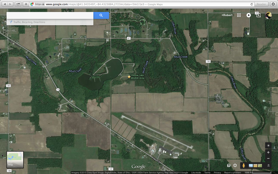
One of the coolest things to do with this Google Maps tool is to check out the satellite imagery. You can get ahold of a pretty decent areal image of what you've never visited. Check out the picture below. I have highlighted the areas of interest with light blue to show you what I mean.
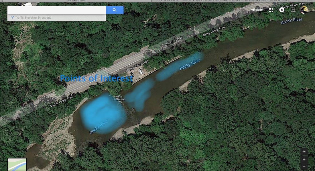
I selected this little portion of the stream because of it's accessibility and deeper pools created by the roadway and small dam. These pools are suspect spots to grab onto some bass relaxing in the deeper water on both sides of the dam.
Also note that you can get a size estimate from not only cars parked in the lot but also the bottom right corner of google Maps. 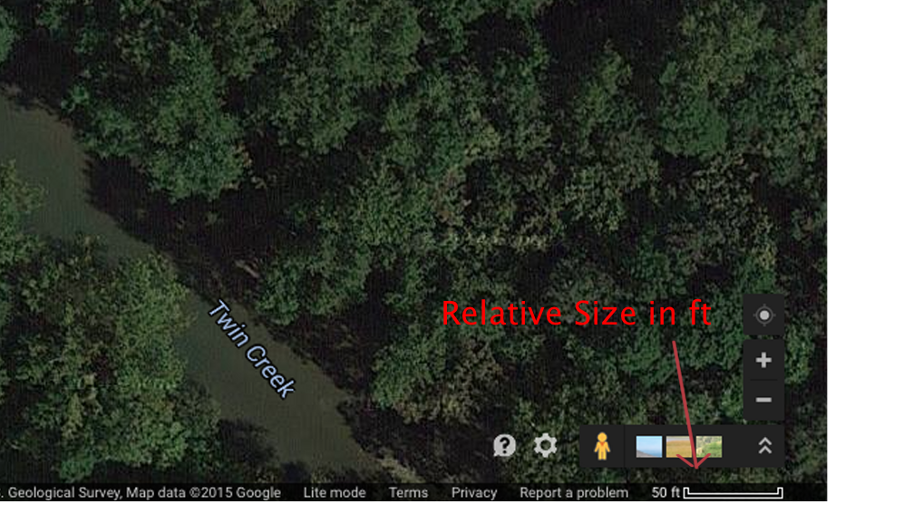
Having fished twin creek I know rarely would I need a rod over 4/5 wt. You need something smaller and lighter but stiff enough to throw those smallmouth top waters up to 50 ft or so. That's something you can deduct right from the get-go before you ever pull up to your spot.
Theres something special about finding a secluded spot that is rarely touched by other anglers. You hear nothing but the babble of the stream, see the deer silently cross ahead of you, and of course pull up a lunker smallmouth from that point you knew looked good on the satellite. Venture out a little further and discover something you may be missing, there's a whole lot of water left.
|
AuthorRobbie is the creator of WF and loves to spend time in the outdoors chasing steelhead, upland birds, and the beauty of nature. Archives
February 2017
Categories
All
Sites to Check Out
|

 RSS Feed
